Akron's industrial expansion in the early 20th century left a patchwork of fill, old foundations, and re-graded terraces that still shape how we approach every soil mechanics study today. The city sits on the Glaciated Allegheny Plateau, where Wisconsinan-age till overlies Pennsylvanian shale and sandstone of the Pottsville Formation. Downtown, near the Ohio & Erie Canal corridor, we routinely encounter 8 to 15 feet of silty clay with sand lenses before hitting weathered shale — a profile that demands careful sampling and lab testing. Whether the project is a new mid-rise near the University of Akron or a stormwater basin in the Merriman Valley, understanding how these layers behave under load is what drives our fieldwork and analysis.
Akron's glacial till can look uniform in a split spoon but behave very differently across a single site — lab consolidation and triaxial testing make that variability measurable.
Process overview
Local context
At 1,066 feet above sea level on the eastern edge of the Allegheny Plateau, Akron's topography creates drainage pathways that concentrate water in buried valleys and along the Tuscarawas River tributaries. The 2023 storm events in Summit County showed how quickly saturated fine-grained soils lose strength — we measured pore pressure increases in monitoring wells that correlated with a 30–40 % drop in Su in the upper clay layer within 48 hours. Slope instability in the Merriman Road area, where cut faces in shale-till sequences exceed 20 feet, becomes a real concern when the weathered shale interface acts as a perched water table. Our soil mechanics study quantifies these seasonal strength changes so the foundation design accounts for the worst-case saturated condition, not just the dry-summer profile.
Reference standards
ASTM D1586-18 — Standard Test Method for Standard Penetration Test (SPT) and Split-Barrel Sampling of Soils, ASTM D2487-17 — Standard Practice for Classification of Soils for Engineering Purposes (Unified Soil Classification System), ASTM D4767-11(2020) — Standard Test Method for Consolidated Undrained Triaxial Compression Test for Cohesive Soils, IBC 2021 Chapter 18 — Soils and Foundations, ASCE 7-22 — Minimum Design Loads and Associated Criteria for Buildings and Other Structures
Additional services
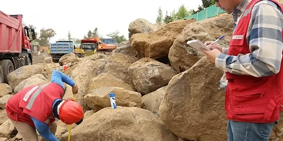
Field Drilling and Sampling
Mud-rotary and hollow-stem auger borings to 40–80 feet depth through glacial drift and into shale bedrock. We log every run, recover Shelby tubes in clay layers, and measure SPT N-values at 2.5-foot intervals per ASTM D1586.
Laboratory Strength and Consolidation Testing
Triaxial compression (CU and UU), direct shear, and one-dimensional consolidation on undisturbed samples. We report effective stress parameters, compression index, and overconsolidation ratio — numbers that directly feed settlement and bearing capacity calculations.
Construction-Phase Soil Verification
Proof-rolling observations, nuclear density testing, and re-compaction Proctor checks during earthwork. When the fill is thicker than the borings suggested, we adjust the soil mechanics study recommendations on the spot to keep the project moving.
Typical parameters
Quick answers
What is the typical soil profile for downtown Akron near the canal?
Most downtown sites show 8 to 15 feet of brown silty clay with sand seams — this is glacial till reworked by post-glacial stream activity. Below that, a stiff gray clay layer 5 to 10 feet thick transitions into weathered shale of the Pottsville Formation at 20 to 30 feet depth. Groundwater is usually encountered at 8 to 12 feet, fluctuating with seasonal rainfall and canal stage.
How much does a soil mechanics study cost for a single-family home lot in Akron?
For a standard residential lot in Summit County, a soil mechanics study with two borings to 25 feet, lab classification, and a foundation recommendation report typically falls in the range of US$2,810 to US$4,530. The final cost depends on access, depth to bedrock, and whether consolidation or triaxial testing is required by the building department.
Do I need a soil mechanics study for a retaining wall under 4 feet?
Akron's building code generally exempts walls under 4 feet from a full geotechnical report, but we strongly recommend at least a shallow boring and lab classification if the wall retains a driveway or is near a property line. The till-derived soils in the area can lose significant strength when saturated, and even a small wall can rotate if the backfill isn't designed for the actual soil properties.
What lab tests are most important for Akron's glacial soils?
Consolidation testing (ASTM D2435) tells us how much settlement to expect under load, which is critical for the compressible clay layers common in the Cuyahoga Valley. Direct shear or triaxial CU tests give drained and undrained strength parameters. Atterberg limits and grain-size distribution complete the classification so we can assign the correct USCS group symbol and correlate with local experience.